Lutherstadt Wittenberg
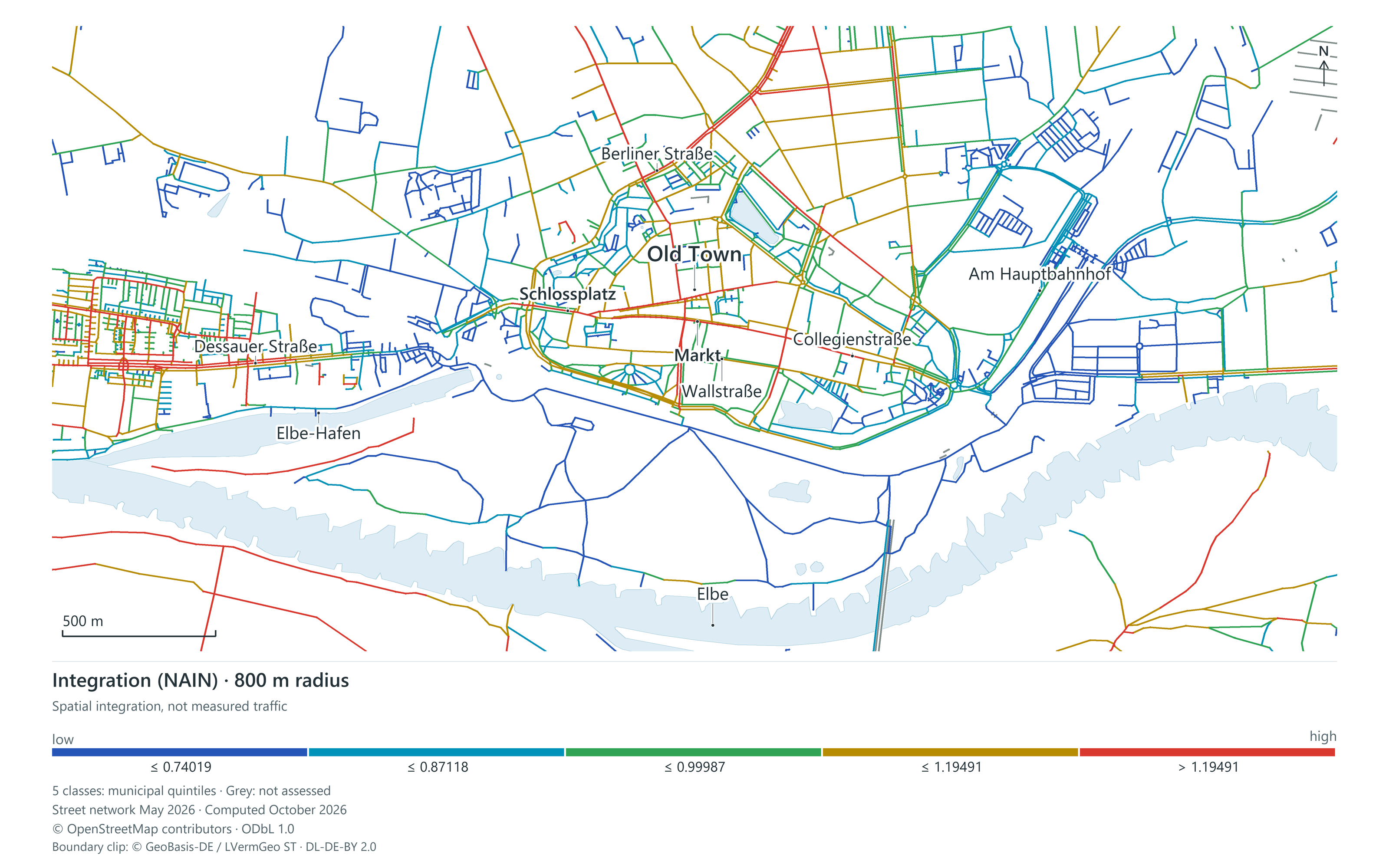
Integration NAIN · radius 800 m. The opening image shows a detail; the complete map and legend follow below.
View the complete map and legend Explore Wittenberg’s network analysisThe complete analysis map

Integration NAIN · radius 800 m. Colours show calculated network relationships, not counted visitors. Street network: 6 May 2026. Water: 6 October 2026. © OpenStreetMap contributors, ODbL · © GeoBasis-DE / LVermGeo ST, DL DE BY 2.0.
Open the map at its original sizePlaces, access to local amenities and spatial relationships make Wittenberg understandable and raise concrete questions for its development. Marco Gernt Architekten is developing a publicly accessible research environment for this purpose. The work is ongoing. Study status: October 2026.
Consider routes, destinations and terrain together
Our work combines a Space Syntax analysis of the street network with official building and terrain data and publicly recorded amenities. Integration and Choice describe spatial relationships within the network. An accessibility assessment adds routes to specific destinations and the influence of gradients.
The city model makes buildings and open spaces explorable. Spatial relationships can be examined in the historic centre and other districts, and possible new connections can be compared as explicitly labelled scenarios.
Turn research into development questions
Where do existing amenities complement one another? Where does a detour make access difficult? Which connection deserves an on-site investigation? The analysis helps select these questions. Network indicators are not measured visitor numbers; terrain, data completeness and actual access conditions limit what can be concluded. On-site observations must test model assumptions before they inform design or investment decisions.
MGA can adapt this approach to other cities using a documented street network, local amenities and specific challenges in existing places. The result is a traceable basis for urban development and architecture.
Explore the study
- Wittenberg urban research
- Spatial analysis of the historic centre
- Time horizons: existing conditions and possible development
Data and image credit
The map shows spatial integration in Wittenberg’s street network: NAIN at an 800-metre radius. Five colour classes use city-wide quintile thresholds, from lower to higher integration. The Elbe and place names provide context. Data snapshots: street network 6 May 2026, water features 6 October 2026. Calculation: Marco Gernt Architekten, 6 October 2026. Cartography: Marco Gernt Architekten, 9 October 2026. Routes and water features: © OpenStreetMap contributors, ODbL. Municipal boundary: © GeoBasis-DE / LVermGeo ST, Data licence Germany, attribution, version 2.0. Higher integration is neither a measured visitor count nor an investment forecast.
The analysis network and publicly recorded amenities are based on OpenStreetMap: © OpenStreetMap contributors, ODbL. Official terrain and statistical sources, with their respective data dates, are credited alongside the relevant displays. Historic research is distinguished from current data snapshots.